Geophysical Survey Reveals a 42-Meter-Deep Hole at the Deepest Point of the Mekong River, Bueng Kan Province
- Thanet Natisri
- 4 hours ago
- 2 min read

11 May 2026
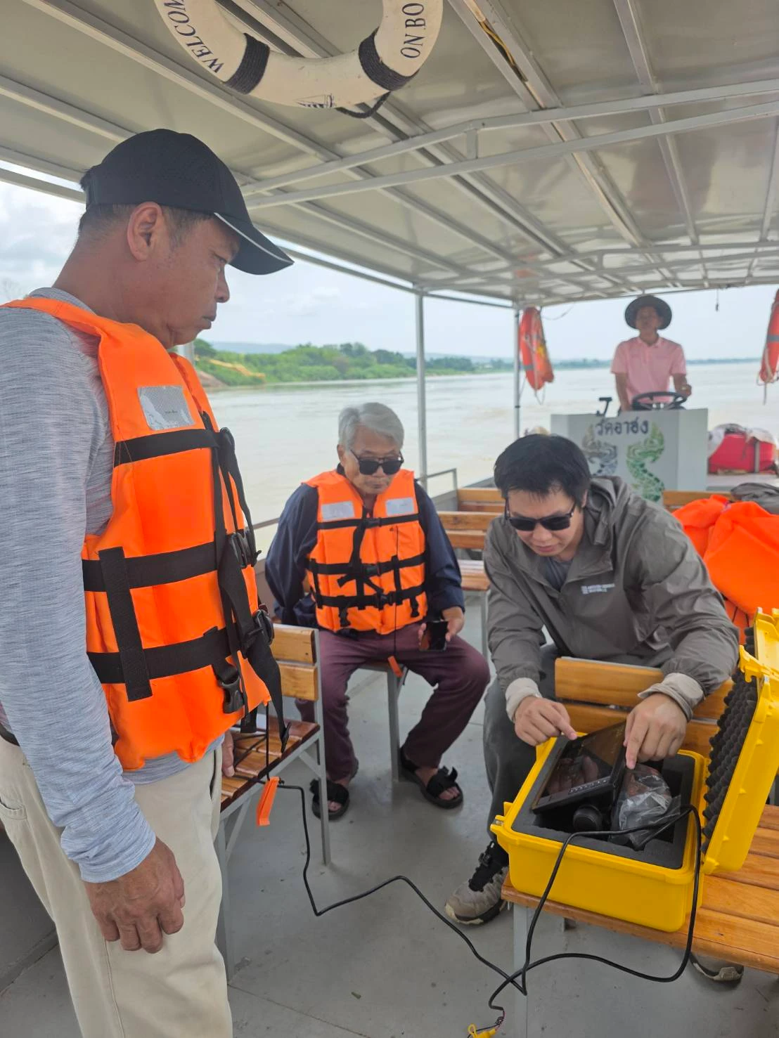
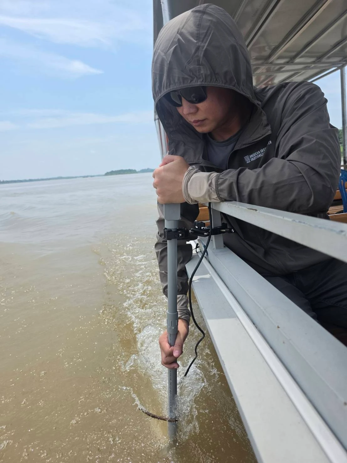
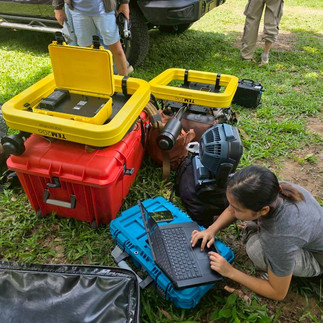
The Community Water Management Fund (Inspired by the Thai Royal Initiative), led by Mr. Thanet Natisri, Project Director, in collaboration with GeoTEMx Co., Ltd. and American Groundwater Solutions, LLC, conducted a geophysical and geological investigation at the deepest point of the Mekong River ("Sadoe Mae Khong") near Wat Ahong Silawas, Khaisri Subdistrict, Mueang Bueng Kan District, Bueng Kan Province, Thailand.
The objective of the survey was to investigate the underwater geological structure, riverbed stratigraphy, and subsurface conditions to better understand the area's geological characteristics and groundwater potential.
Survey Findings
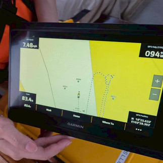
The investigation identified the deepest section of the Mekong River approximately 70 meters downstream of the temple pier. The feature forms a large underwater depression measuring approximately 48 meters in diameter with a maximum depth of 42 meters. At the time of the survey, the river water level was approximately 10 meters below the riverbank elevation. Several additional deep holes were also identified along the Thai side of the river.
Geological interpretation indicates that the shallow riverbed consists primarily of mixed sediments, sand, and gravel, with localized clay deposits. Between 5 and 15 meters below the riverbed, sandstone and silty sandstone layers were identified. At greater depths, the subsurface transitions into alternating layers of clay, silt, and sand, reflecting the complex geological history of the Mekong River.
Scientific Significance
The findings provide valuable information for understanding the geological evolution of the Mekong River, supporting future studies of underwater geology, groundwater resources, river morphology, and sustainable water resource management throughout the region.
This project demonstrates how advanced geophysical technologies can reveal critical subsurface information beneath rivers without intrusive investigation, providing high-quality scientific data for environmental research, engineering applications, and long-term resource management.
GeoTEMx continues to advance geophysical innovation by transforming complex subsurface data into actionable intelligence—helping governments, researchers, and communities make informed decisions for a more sustainable future.


Comments